Magnetic data
Type of resources
Available actions
Topics
Keywords
Contact for the resource
Provided by
Years
Formats
Representation types
Update frequencies
Service types
Scale
-
GIS versions of a regional structural summary and palaeogeographic reconstructions describing the Palaeozoic geology of parts of the UK offshore and onshore, plus a set of summary posters and a summary presentation capturing the conventional petroleum systems. Devonian and Carboniferous rocks are the focus in and around the Mid North Sea High, Central North Sea, the Moray Firth and Orcadian Basin. In the greater Irish Sea area, Carboniferous rocks are described. The peer-reviewed products were produced for the 21CXRM Palaeozoic Project by BGS for DECC/OGA, Oil and Gas UK and oil company sponsors between November 2014 and May 2016, to improve regional digital datasets and knowledge of the underexplored Palaeozoic petroleum systems, and to stimulate exploration. The petroleum systems analysis was based on new interpretations of extensive well, seismic, gravity-magnetic and source rock datasets, integrated with petrophysical studies, basin modelling and UK onshore knowledge. Released data were collated and interpreted, and interpretations of unreleased data were included with agreement of the data owners. Unreleased raw data is excluded, as is the UK Government Seismic data released in 2016. The GIS layers were digitised from figures prepared for project reports and are applicable for use at scales between 1:1,000,000 and 1:3,000,000.
-
These data are derived from a voyage on Australia’s R/V Investigator, IN2019_v04, ‘Hotspot dynamics in the Coral Sea: connections between the Australian plate and the deep Earth’. The voyage surveyed the Tasmantid and Lord Howe Seamounts in the Tasman and Coral Seas, together with the Louisiade Plateau in the Coral Sea, sailing from Cairns on 7 Aug 2019 and arriving in Brisbane on 3 Sep 2019. The voyage summary is available at https://www.marine.csiro.au/data/reporting/get_file.cfm?eov_pub_id=1443. This directory includes the ship data, in some cases with initial onshore processing done by CSIRO technical staff (e.g., the underway data). More details are available in the README file.
-
This layer of the map based index (GeoIndex) shows the location of land and marine gravity observations on the UK mainland, Northern Ireland, offshore islands, tidal estuaries and seabed. Most of the surveys were carried out by the BGS but the database includes data originally acquired by other organisations and subsequently given to the BGS to be managed as part of the national archive. Complete coverage of the UK mainland with a station density of 1-2 stations per square kilometre. Unadjusted ship gravity, magnetic and bathymetry data acquired by BGS as part of its Offshore Reconnaisance Mapping Programme. Unadjusted ship gravity, magnetic and bathymetry data acquired by BGS as part of its Offshore Reconnaisance Mapping Programme. This programme commenced in 1967, and was funded mainly by the Department of Energy. Marine gravity readings are from unadjusted ship gravity and bathymetry data from various commercial and academic surveys between 1965 and 1994. Confidential M.O.D Hydrographic Office integrated ship gravity and magnetics surveys of NW Europe marine areas for which BGS acts as agent. Network adjusted gravity and magnetic compilations of data from BGS and non-BGS sources.
-
Reports, images, GIS and gridded products describing the Palaeozoic geology and conventional petroleum in and around the Mid North Sea High (Quadrants 25-44). Covering a large area of the Central North Sea from the Forth Approaches to the northern side of the Southern North Sea, the focus is on Devonian and Carboniferous rocks. The peer-reviewed products were produced for the 21CXRM Palaeozoic Project by BGS for DECC/OGA, Oil and Gas UK and oil company sponsors between November 2014 and May 2016, to improve regional digital datasets and knowledge of the underexplored Palaeozoic petroleum systems, and to stimulate exploration. The petroleum systems analysis was based on new interpretations of extensive well, seismic, gravity-magnetic and source rock datasets, integrated with petrophysical studies, basin modelling and UK onshore knowledge. Released data were collated and interpreted, and interpretations of unreleased data were included with agreement of the data owners. Unreleased raw data is excluded, as is the UK Government Seismic data released in 2016. The datasets are applicable for use at scales between 1:750,000 to 1: 3,000,000.
-
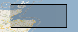
Reports, images, GIS and gridded products describing the Palaeozoic geology and conventional petroleum systems of parts of the UK offshore from the Orcadian Basin, Moray Firth to northern Forth Approaches (Quadrants 6-21). Devonian and Carboniferous rocks are the focus. The peer-reviewed products were produced for the 21CXRM Palaeozoic Project by BGS for DECC/OGA, Oil and Gas UK and oil company sponsors between November 2014 and May 2016, to improve regional digital datasets and knowledge of the underexplored Palaeozoic petroleum systems, and to stimulate exploration. The petroleum systems analysis was based on new interpretations of extensive well, seismic, gravity-magnetic and source rock datasets, integrated with petrophysical studies, basin modelling and UK onshore knowledge. Released data were collated and interpreted, and interpretations of unreleased data were included with agreement of the data owners. Unreleased raw data is excluded, as is the UK Government Seismic data released in 2016. The datasets are applicable for use at scales between 1:750,000 to 1: 3,000,000
-
Data from the British Geological Survey's GeoIndex Geophysics theme are made available for viewing here. GeoIndex is a website that allows users to search for information about BGS data collections covering the UK and other areas world wide. Access is free, the interface is easy to use, and it has been developed to enable users to check coverage of different types of data and find out some background information about the data. More detailed information can be obtained by further enquiry via the web site: www.bgs.ac.uk/geoindex.
-
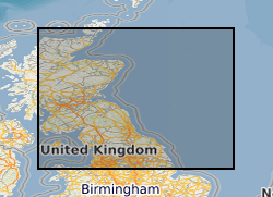
Reports, images, GIS and gridded products describing the Palaeozoic geology and conventional petroleum systems of parts of the UK offshore. Devonian and Carboniferous rocks are the focus in and around the Mid North Sea High, Central North Sea, the Moray Firth and Orcadian Basin. In the greater Irish Sea area, Carboniferous rocks are described. The peer-reviewed products were produced for the 21CXRM Palaeozoic Project by BGS for DECC/OGA, Oil and Gas UK and oil company sponsors between November 2014 and May 2016, to improve regional digital datasets and knowledge of the underexplored Palaeozoic petroleum systems, and to stimulate exploration. The petroleum systems analysis was based on new interpretations of extensive well, seismic, gravity-magnetic and source rock datasets, integrated with petrophysical studies, basin modelling and UK onshore knowledge. Released data were collated and interpreted, and interpretations of unreleased data were included with agreement of the data owners. Unreleased raw data is excluded, as is the UK Government Seismic data released in 2016. The datasets are applicable for use at scales between 1: 750,000 to 1: 3,000,000.
-
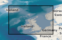
This dataset is the complete collection of the British Geological Survey (BGS) held Marine Survey data. The data held includes digital data and analogue records, plus associated physical sample material. Data are stored within the National Geosciences Data Centre (NGDC) and the Marine Environmental Data and Information Network (MEDIN) Data Archive Centre (DAC) for Geology and Geophysics. BGS have collected Marine Survey data since 1966 and have also been provided with a range of third-party data. The data includes geophysical data (seismic reflection, side-scan sonar, multibeam echosounder bathymetry and backscatter, gravity and magnetics) and sample data from boreholes, cores and seabed grabs (logs, geological descriptions, geochemical, particle size analysis and geotechnical data). The majority of surveys are within the United Kingdom Continental Shelf (UKCS) area. Individual survey data coverage varies, depending on survey type (sampling, geophysics, multibeam or multi-disciplinary) and objectives (regional or local, shallow or deep). These data are applicable to a wide range of uses including environmental, geotechnical, geophysical and geological studies. Data are delivered via the BGS Offshore GeoIndex www.bgs.ac.uk/GeoIndex/offshore.htm. Additional data are available on request enquiries@bgs.ac.uk.
-
The Marine Aggregate Levy Sustainability Fund (MALSF) commissioned a series of Regional Environmental Characterisation (REC) surveys via the Marine Environment Protection Fund (MEPF) to develop understanding of submerged habitats and heritage in Britain. The aim was to acquire high quality data to enable broad scale characterisation of the seabed habitats, their biological communities and potential historic environment assets. The surveys were conducted in the following areas - Outer Bristol Chanel (2003 – 2005), Eastern English Channel (2005 – 2006), South Coast (2007 - 2010), Outer Thames (2007), East Coast (2008 - 2009), Humber (2008 - 2009). The Geology and Geophysics component of the data are archived by British Geological Survey (BGS) in the Marine Environmental data and Information Network (MEDIN) Data Archive Centre (DAC) for Geology and Geophysics. The data includes bathymetry, sidescan sonar, sub-bottom profiler, magnetometer, seabed video and photographs, Particle Size Analysis (PSA) data, vibrocore (logs and images). Data are delivered via the BGS Offshore GeoIndex www.bgs.ac.uk/GeoIndex/offshore.htm. Additional data are available on request enquiries@bgs.ac.uk. Other data types have been archived with the other MEDIN DACs as appropriate (UKHO DAC for bathymetry data and DASSH DAC for biological data). The MALSF ceased operation at the end of March 2011 (http://www.marinealsf.org.uk/).
 NERC Data Catalogue Service